

🌊 A Flood Watch Is Up, and Isaias Is a Hurricane Now: Your Weather & Outdoors Ahead
Or: The Coast Gets the Hurricane. We Get a Good Soaking, a Breezy Saturday and One Simple Rule for the Creeks
A storm can grow a lot in a day, the way a quiet creek can rise after one hard rain. Yesterday morning, Isaias was a tropical storm with 45 mph winds. By Thursday evening it was a hurricane with 100 mph winds.
That change is for the Gulf Coast, not for our ridges. What changed for us is smaller and more practical. Sequatchie County is now under a Flood Watch, Dunlap’s Saturday looks wetter and breezier than it did yesterday, and a separate wind watch covers our neighbors in Marion and Hamilton counties.
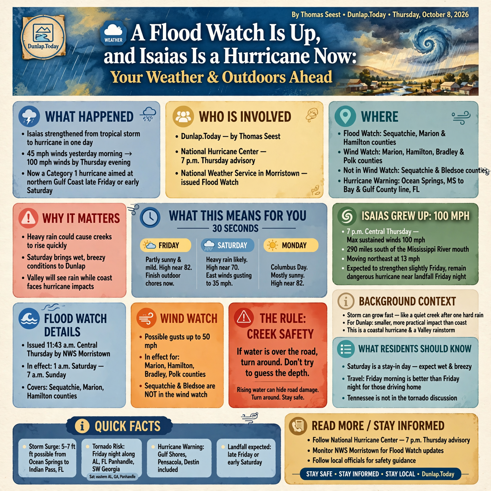
Here’s the update: Isaias is a hurricane aimed at the northern Gulf Coast late Friday or early Saturday, a Flood Watch for Sequatchie, Marion and Hamilton from 1 a.m. Saturday until 7 a.m. Sunday, Dunlap’s day-by-day forecast, who is and isn’t in the High Wind Watch and a short Friday list so Saturday can be a stay-in day.
⏱️ What this means for you in 30 seconds
- Friday: Partly sunny and mild, high near 82 in Dunlap. That’s the day to finish outdoor chores.
- Saturday: Heavy rain is likely, high near 70, with east winds gusting up to 35 mph. A Flood Watch runs from 1 a.m. Saturday until 7 a.m. Sunday.
- Sunday: Showers mainly before 1 p.m., then it eases. Monday, Columbus Day, looks mostly sunny and near 82.
- Wind watch: Possible gusts up to 50 mph are in the watch for Marion, Hamilton, Bradley and Polk counties. Sequatchie and Bledsoe are not named in that watch.
- The rule: If water is over the road, turn around. Don’t try to guess the depth.
🌀 Isaias Grew Up: 100 mph, and a Warning on the Coast

At 7 p.m. Central on Thursday, the National Hurricane Center’s intermediate advisory said Hurricane Isaias had maximum sustained winds near 100 mph and was about 290 miles south of the mouth of the Mississippi River, moving northeast near 13 mph. Forecasters expect a little more strengthening early Friday, and they expect it to stay a dangerous hurricane as it nears the northern Gulf Coast Friday night. Landfall inside the warning area is expected late Friday or early Saturday.
A Hurricane Warning is up from Ocean Springs, Miss., to the Bay and Gulf County line in Florida. That includes fall-break towns such as Gulf Shores, Pensacola and Destin. A Storm Surge Warning runs from the mouth of the Mississippi River to the Suwannee River, with water possibly 5 to 7 feet above ground in places from Ocean Springs to Indian Pass, Fla. The center said the serious tornado risk with this storm starts Friday night along the coast of Alabama, the Florida Panhandle and far southwest Georgia, then continues Saturday in eastern Alabama, Georgia and the Panhandle. Tennessee is not in that tornado discussion.
What it means for you: This is still a coastal hurricane and a Valley rainstorm. If family or customers are inside the warning area, the hurricane center says preparations there should be finished now, and they should follow local officials. If your people are driving home, Friday morning is a better window than Friday night. For us, the rain arrives after that.
👉 Read more (National Hurricane Center, 7 p.m. Thursday advisory)
🌧️ A Flood Watch for Sequatchie, Marion and Hamilton
At 11:43 a.m. Central Thursday, the National Weather Service in Morristown issued a Flood Watch from late Friday night through Sunday morning for Sequatchie, Marion, Hamilton, Bradley and Polk counties, plus Cherokee and Clay counties in North Carolina. Dunlap’s point forecast times that watch from 1:00 a.m. Saturday until 7:00 a.m. Sunday.
The watch says flooding from heavy rain is possible, and that creeks and streams may rise out of their banks. It expects Hurricane Isaias to bring moderate to heavy rain early Saturday morning through early Sunday, with widespread totals of 1 to 3 inches. Repeated rounds of heavier rain could cause flash flooding. The Morristown office’s afternoon outlook also said heavy rain is possible on the Plateau and in southeast Tennessee, with breezy conditions areawide.
Bledsoe County is not named in this Flood Watch. Pikeville will still see the same storm system, so the same creek caution applies. A separate Nashville office watch covers much of Middle Tennessee, including Grundy County, on the same hours. It does not include Sequatchie.
What it means for you: Think of a flood watch the way you’d think of a pot that’s not boiling yet. Nothing is wrong this minute. You just don’t walk off and forget it. Move cars off low spots Friday, clear leaves from drains and culverts, and keep kids and pets away from ditches once the rain starts. If you live near a creek that has come up before, have a simple plan for where you’d go if it rises again. A watch is not a warning. If a Flood Warning is issued later, that means flooding is happening or about to happen, and it’s time to act on that plan.
👉 Read more (National Weather Service Morristown watches) · Hazardous Weather Outlook
📅 Dunlap, Day by Day, as of Thursday Evening

The National Weather Service point forecast for Dunlap, updated at 6:06 p.m. Central Thursday, looks like this:
- Tonight: Mostly cloudy, low around 57.
- Friday: Partly sunny, high near 82. A calm day to finish the yard.
- Friday night: A 30 percent chance of showers, mainly after 5 a.m., with gusts up to 25 mph. Low around 58.
- Saturday: Showers, with thunderstorms possible after 10 a.m. Some storms could produce heavy rain. High near 70. East wind 10 to 15 mph, gusts as high as 35 mph. Rain chance 90 percent.
- Saturday night: Showers and possibly a thunderstorm. Rain chance 100 percent. Gusts still up to 35 mph. Low around 59.
- Sunday: Showers, mainly before 1 p.m. High near 73. Rain chance 80 percent, then it tapers.
- Sunday night: A 20 percent chance of a shower before 1 a.m.
- Monday, Columbus Day: Mostly sunny, high near 82. Tuesday looks sunny and near 86.
What it means for you: Friday is the porch-sweeping day. Saturday is soup and a puzzle. Sunday afternoon may dry enough for a short walk, but don’t plan a picnic. Monday looks like a reset, which is good news for school buses and anyone who put off a chore. Numbers can still shift overnight. Check the forecast once more Friday morning before you lock in plans.
👉 Read more (National Weather Service forecast for Dunlap)
💨 The Wind Watch Is Next Door, Not on Dunlap’s Name
Morristown also posted a High Wind Watch from Saturday morning through Sunday morning for Marion, Hamilton, Bradley and Polk counties, plus two counties in North Carolina. It says east winds of 15 to 25 mph, with gusts up to 50 mph possible, could blow down trees and power lines. A separate mountain watch farther east talks about even stronger gusts in the Smokies. Sequatchie County and Bledsoe County are not listed in the High Wind Watch.
That lines up with Dunlap’s own forecast, which tops out at 35 mph gusts, not 50. Jasper, Whitwell, South Pittsburg, Chattanooga and Signal Mountain are in the wind watch. Dunlap and Pikeville are not.
What it means for you: If you live in Dunlap, this is a tie-down-the-trampoline breeze, not a take-cover wind. If you live or work in Marion or Hamilton, or you have family there, take the watch more seriously. Put away light outdoor things Friday, charge phones and know how you’ll report an outage. Sequachee Valley Electric Cooperative posts outage information online. Don’t go near a downed line, and run any generator outdoors, away from doors and windows.
👉 Read more (High Wind Watch text) · Sequachee Valley Electric Cooperative outages
🚧 Creeks, Ditches and the One Driving Rule That Matters
The first big rain after a dry spell can run off fast, because hard ground drinks slowly at first. The Flood Watch specifically mentions creeks, streams and low places. The National Weather Service says just 12 inches of moving water can carry away most cars, and 6 inches can knock a person down.
What it means for you: Saturday is a bad day to “see if you can make it” across a dip in the road. Turn around and use another way, even if it adds 10 minutes. That’s also true for farm paths and creek crossings. If you were headed to an outdoor market or a ball game Saturday, check with the organizers Friday. A lot of small stands would rather close than lose a day’s goods to wind and rain. Monday’s sunshine is the better day for anything that can wait.
👉 Read more (Turn Around, Don’t Drown)
✅ Your Friday Checklist Before the Rain
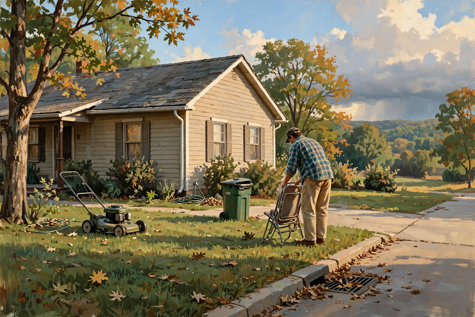
- ✅ Finish mowing, gutter cleaning and limb pickup Friday, while it’s still partly sunny.
- ✅ Put up lawn chairs, trash cans, trampolines and sidewalk signs before dark Friday.
- ✅ Clear leaves from storm drains, culverts and downspouts so water has somewhere to go.
- ✅ Park off low ground. If a creek has flooded your road before, have another route in mind.
- ✅ Charge phones and set a flashlight where you can find it in the dark.
- ✅ In Marion or Hamilton counties, treat the High Wind Watch as a real chance of tree and power-line trouble Saturday.
- ✅ Keep weather alerts on overnight Saturday. A watch can become a warning.
- ✅ If water covers the road, turn around. No errand is worth it.
- ✅ Families still on the Gulf Coast: leave Friday morning if you can, before the warning area gets the storm.
Practical rule: Use Friday to button up, stay off flooded roads Saturday, and let Monday’s sun dry things out.
— Dunlap.Today
📚 Plain-English Weather Glossary

- Hurricane: A tropical system with sustained winds of 74 mph or more. Isaias reached 100 mph Thursday evening.
- Hurricane Warning: Hurricane conditions are expected in that area, usually within 36 hours. A watch means they’re possible. The warning is on the Gulf Coast, not here.
- Flood Watch: Flooding is possible. It is a heads-up, not a statement that water is already in the road. A Flood Warning means flooding is happening or about to.
- Flash flooding: Water that rises quickly, often within a few hours, in creeks, ditches and low roads.
- High Wind Watch: Damaging wind is possible. For this storm, the watch near us covers Marion and Hamilton counties, with gusts up to 50 mph possible. Dunlap’s forecast is lower.
- Remnants: What’s left after a hurricane moves inland and weakens. For the Valley, that means rain and gusty wind, not a hurricane.
- Storm surge: Seawater pushed onshore by a storm. It’s a coastal danger. It does not happen in the Sequatchie Valley.
❓ Frequently Asked Questions

Is a hurricane going to hit Dunlap?
No. As of 7 p.m. Thursday, Isaias was a 100 mph hurricane expected to come ashore on the northern Gulf Coast late Friday or early Saturday, then weaken inland. What reaches us is rain and gusty wind.
Is Dunlap in the Flood Watch?
Yes. Sequatchie County, which includes Dunlap, is in the Morristown office’s Flood Watch from 1 a.m. Saturday until 7 a.m. Sunday. Marion and Hamilton counties are in it too. Bledsoe County is not named in that watch.
Are we in the High Wind Watch?
Dunlap is not. The High Wind Watch near us covers Marion, Hamilton, Bradley and Polk counties, with gusts up to 50 mph possible Saturday into Sunday morning. Dunlap’s forecast calls for gusts up to 35 mph.
How much rain should we expect?
The Flood Watch says widespread totals of 1 to 3 inches from early Saturday through early Sunday. The exact amount still depends on the storm’s track. Check the forecast again Friday.
Will Monday be all right for school?
The Thursday evening forecast for Monday shows mostly sunny skies and a high near 82, after a small chance of a shower Sunday night. Schools make their own calls. Follow your district if anything changes.
What if the power goes out?
Sequachee Valley Electric Cooperative posts outage information on its website. Keep the fridge closed, keep generators outside and away from the house, and stay clear of downed lines.
🔗 Other Resources

- National Weather Service: Dunlap forecast
- National Weather Service Morristown
- National Hurricane Center
- Isaias maps, including rainfall
- Flood safety
- Sequachee Valley Electric Cooperative outages
- Ready.gov: a simple family plan
🌤️ Button Up Friday, Then Let It Rain
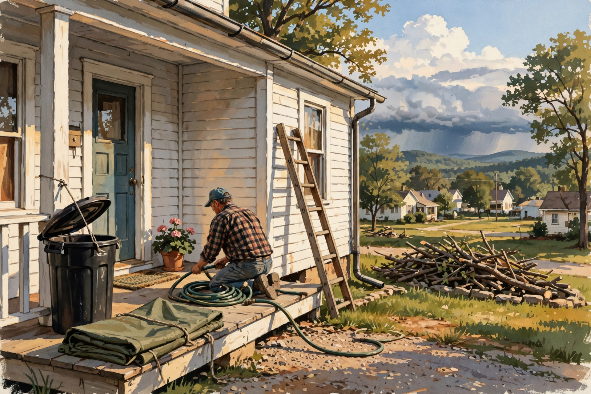
There’s no need to fear this storm from a Dunlap porch. The hurricane part stays on the coast. Our job is the ordinary one: pick up what the wind could toss, give the water a clear path, and stay off a flooded road. Monday looks like a bright reset.
Check on a neighbor who might need a hand with a tarp or a ride, and check the forecast once more Friday morning. We’ll keep the sky in plain English. Read Dunlap.Today for the next update.



0 Comments